Satellite images show Iranian sites before and after airstrikes
Satellite imagery captured Sunday and Monday by Vantor shows the aftermath of the U.S.-Israeli strikes on multiple sites in Iran.
The U.S. struck more than 1,250 targets over the first two days of Operation Epic Fury, according to a fact sheet released by U.S. Central Command, which said the U.S. is hitting targets “to dismantle the Iranian regime’s security apparatus, prioritizing locations that pose an imminent threat.”
The satellite images show damage to sites including the Choqa Balk-e drone facility, former Supreme Leader Ayatollah Ali Khamenei’s compound, the Natanz nuclear complex and a radar system at Zahedan airbase.
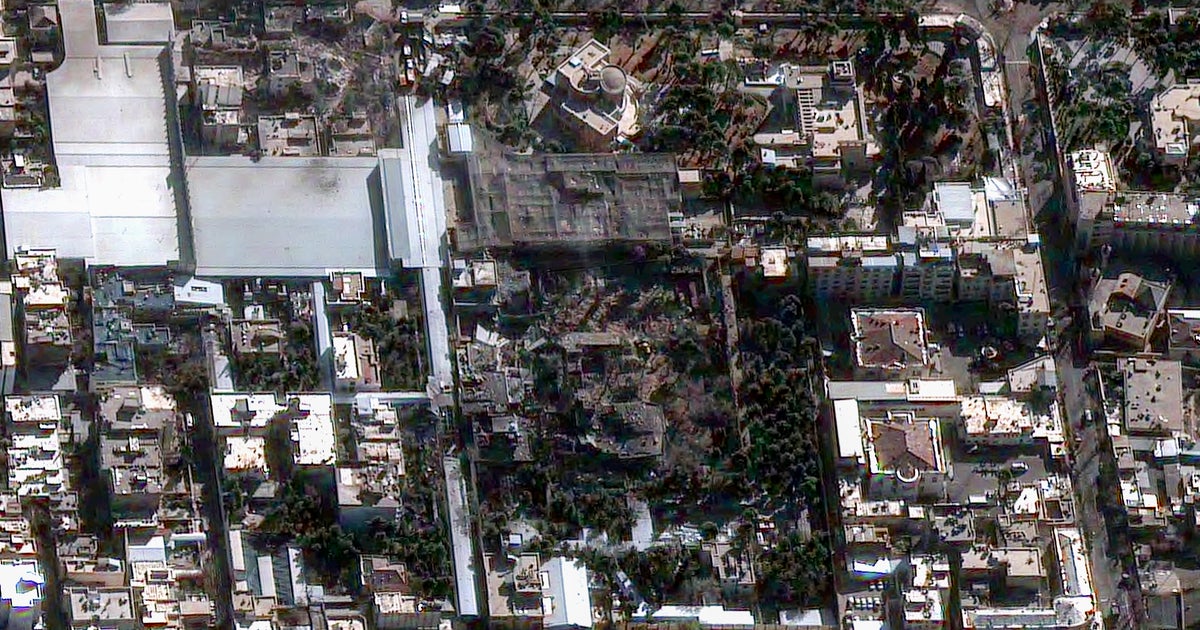
Khamenei compound
Khamenei was killed in one of the initial strikes, along with about 40 other senior Iranian officials. Khamenei’s movements had been tracked for months by the CIA, which learned about a Saturday morning meeting at a compound in Tehran that Khamenei was expected to attend, according to a person familiar with the matter. That intelligence was then passed on to Israeli counterparts, the person told CBS News.
Satellite image ©2026 Vantor 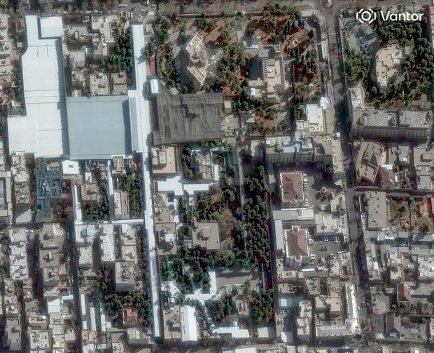
Satellite image ©2026 Vantor 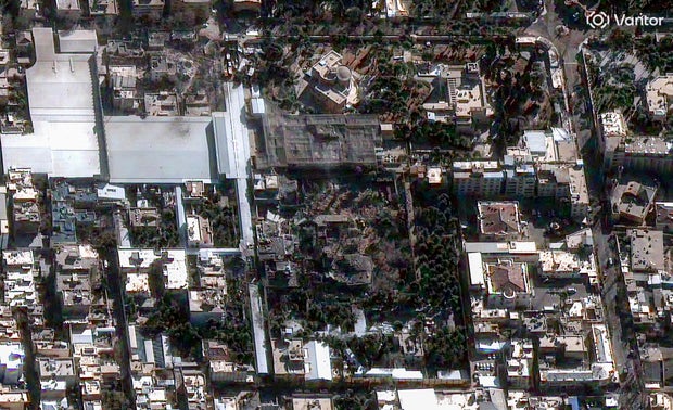
Natanz nuclear facility
The Natanz enrichment facility was one of three nuclear sites that were previously targeted by separate Israeli and U.S. airstrikes in June last year. It was unclear how much those initial strikes damaged Iran’s nuclear program.
President Trump has claimed they “obliterated” the three nuclear sites, and that Iran’s nuclear program had been set back by “basically decades.” Iran downplayed the strikes at the time, arguing they didn’t eliminate its technological capabilities.
“Yes, you destroyed the facilities, the machines, but the technology cannot be bombed, and the determination also cannot be bombed,” Iranian Foreign Minister Abbas Araghchi told Fox News in January.
Satellite images from late January showed roofs had been built over damaged buildings at Natanz and other sites, potentially indicating Iran was trying to salvage materials from the facilities.
Satellite image ©2026 Vantor 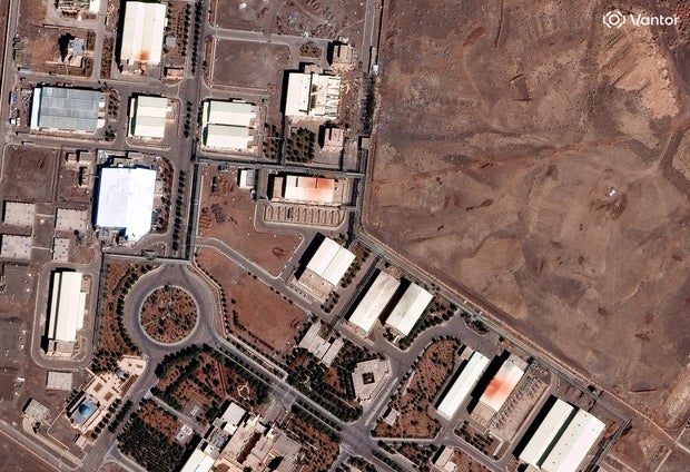
Satellite image ©2026 Vantor 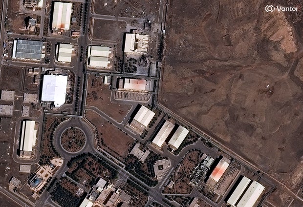
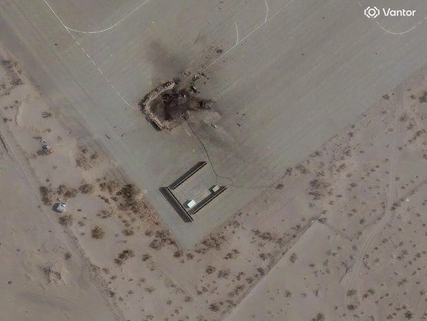
Choqa Balk-e drone facility
The Choqa Balk-e frone facility is located in western Iran. The country is known to use Shahed-136 “kamikaze” drones, a one-way drone that has a warhead built into it that detonates when it crashes into its target.
Satellite image ©2026 Vantor 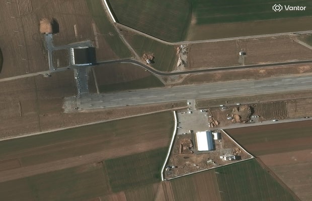
Satellite image ©2026 Vantor 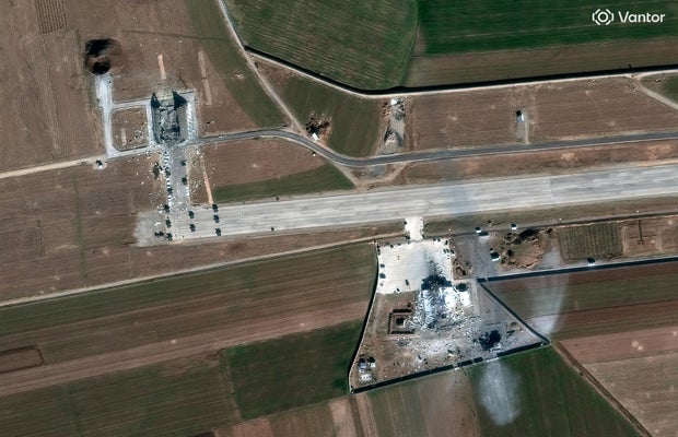
Zahedan airbase radar system
The Zahedan airbase is located in the eastern part of Iran, not far from the country’s borders with Pakistan and Afghanistan.
Satellite image ©2026 Vantor 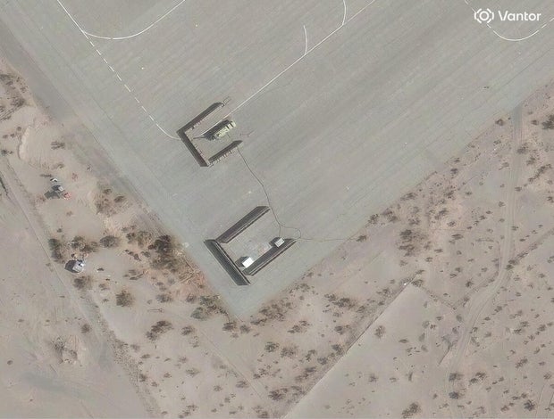
Satellite image ©2026 Vantor