Maps show Canada wildfire smoke forecast for U.S. as dozens of blazes burn out of control
Wildfire smoke from Canada is expected to move over the U.S., impacting air quality for millions of people on Friday and this weekend. Maps and satellite imagery show the large-scale impact of the blazes.
More than 90 fires out of 174 active blazes were burning “out of control” across Canada as of Thursday, according to the Canadian Interagency Forest Fire Center, forcing thousands of people to flee their homes.
A state of emergency was declared in the province of Saskatchewan where over a dozen fires are raging. Earlier this week, 17,000 people were told to flee blazes in Manitoba, a neighboring province that borders North Dakota and Minnesota.
Satellite imagery from Thursday showed a massive smoke plume spanning 3,000 miles from Montana to the Atlantic.
NOAA/CIRA 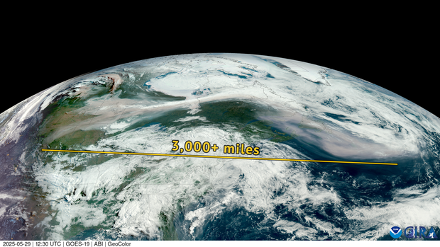
Air quality alerts are covering parts of the Upper Midwest, including areas in Michigan’s Upper Peninsula and northern Minnesota, as well as all of Wisconsin, The Weather Channel reports.
Air quality is expected to be “unhealthy for sensitive groups” on Friday in cities spanning from Madison, Wisconsin, to Duluth, Minnesota, according to the federal site AirNow. Air quality is forecast to be “moderate” in cities including Chicago, Minneapolis, St. Louis, Cincinnati and Detroit.
On Saturday, air quality is expected to worsen in parts of Minnesota, where it is forecast to be “unhealthy,” AirNow said.
Maps show how thick the smoke is expected to be in the U.S. on Friday and Saturday.
CBS News 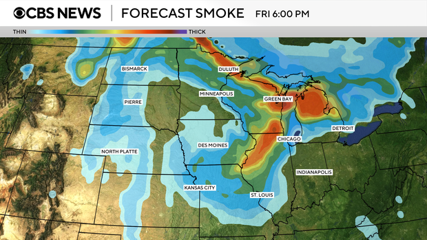
CBS News 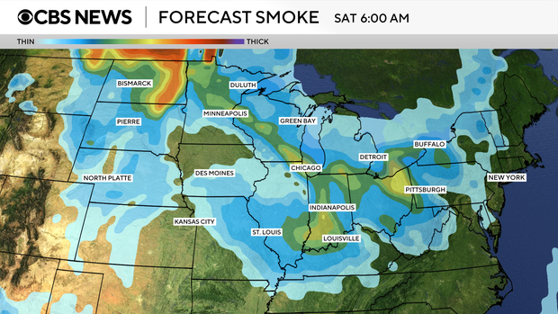
CBS News 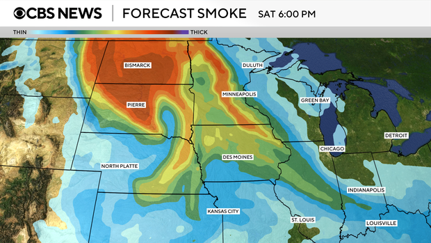
Canadian wildfire smoke led to sweeping air quality issues across the U.S. back in 2023, when hundreds of blazes were raging. Drought and record heat contributed to those fires, which in May and June that year created a record level of emissions.